Landsat-7 ETM+ Satellite Imagery Map
The Landsat Series is a joint USGS and NASA-led enterprise for Earth observation that represents the world's longest running system of satellites for moderate-resolution optical remote sensing for land, coastal areas, and shallow waters. Landsat 7 was launched from Vandenberg Air Force Base in California on April 15, 1999, on a Delta II rocket. The satellite carries the Enhanced Thematic Mapper Plus (ETM+) sensor. This instrument was improved from previous instrumentation designs. The primary features on Landsat 7 include a panchromatic band with 15 meter spatial resolution, an onboard full aperture solar calibrator, five percent absolute radiometric calibration, and a thermal infrared channel with a four-fold improvement in spatial resolution over Thematic Mapper (TM).

Source: U.S. Geological Survey (USGS), EarthExplorer. https://earthexplorer.usgs.gov/
Tags
Drainage Density Map Drainage Network Map Geological Map - Formation Geological Map - Lithology Geomorphological Map Groundwater Flow Direction (Pre-Monsoon) Groundwater Flow Direction (Post-Monsoon) GroundWater Fluctuation Map v2 Landform Classification Map v2 LandUseLandCoverMap 2011 LandUseLandCoverMap 2021 LULC Map for Year 2011 and 2021 River and Lake Link Map Satellite Imagery Map 2011 Satellite Imagery Map 2021 Soil Map v2 Unconfined Aquifer Map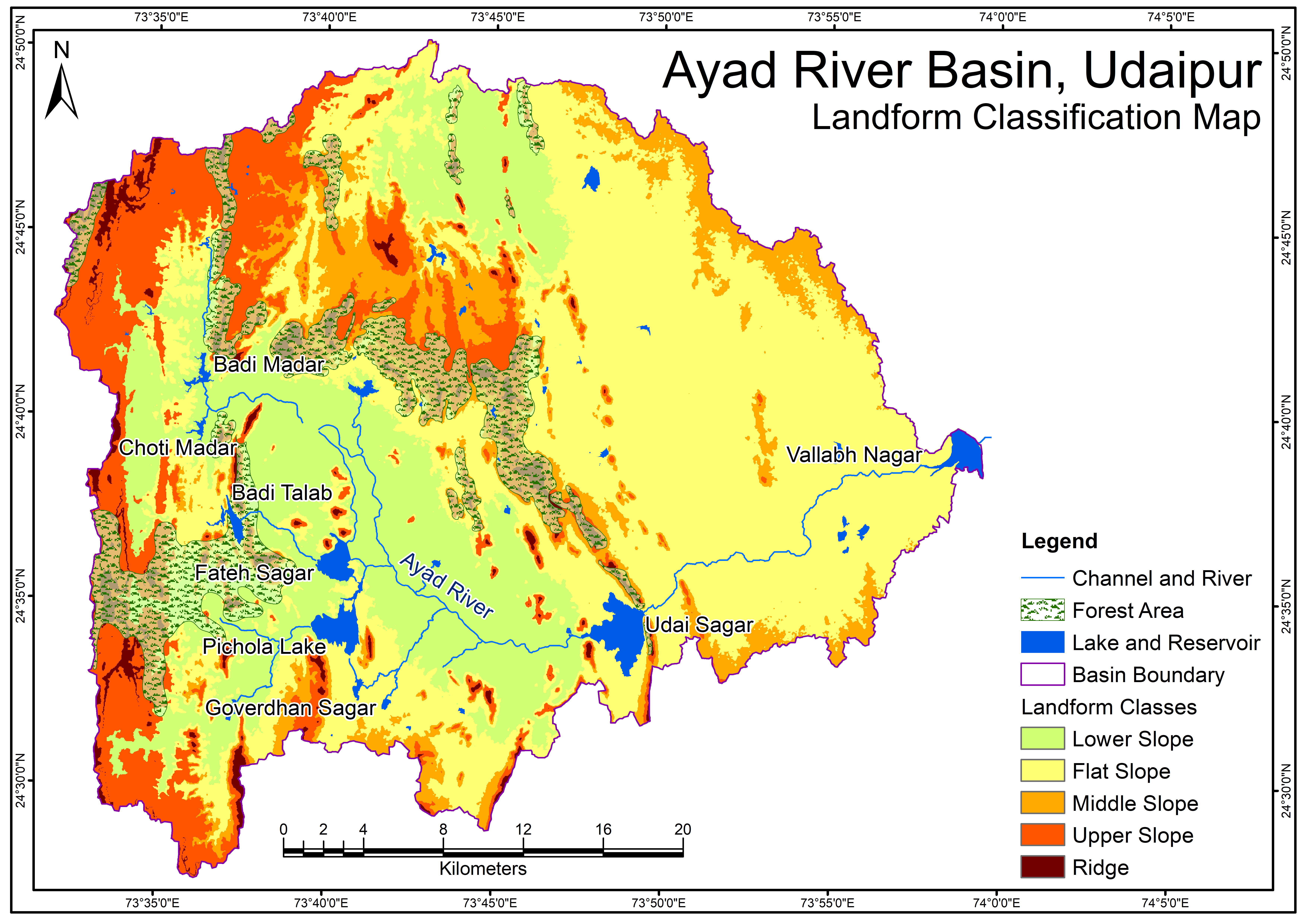
Related images
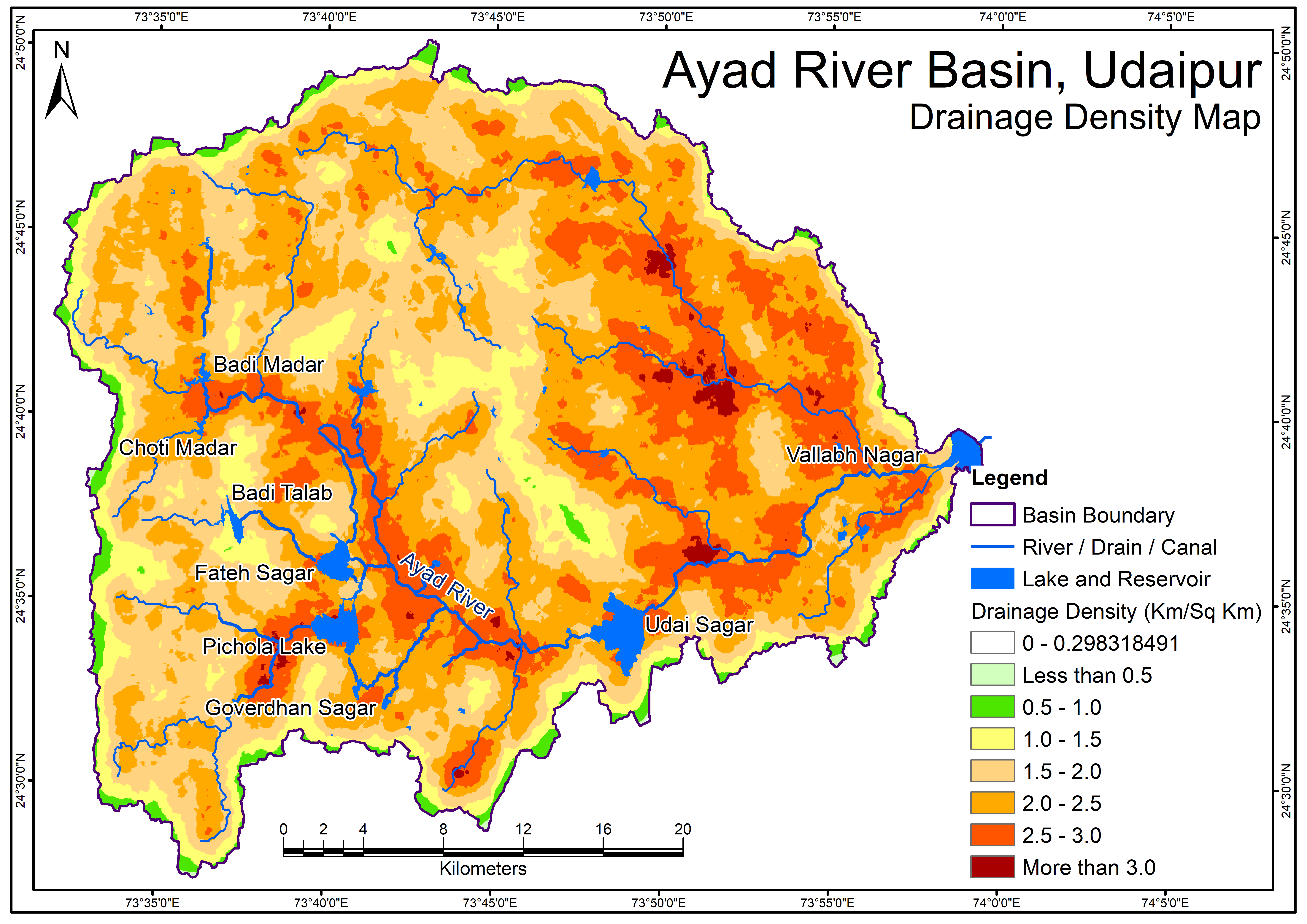
Drainage Density Map
View more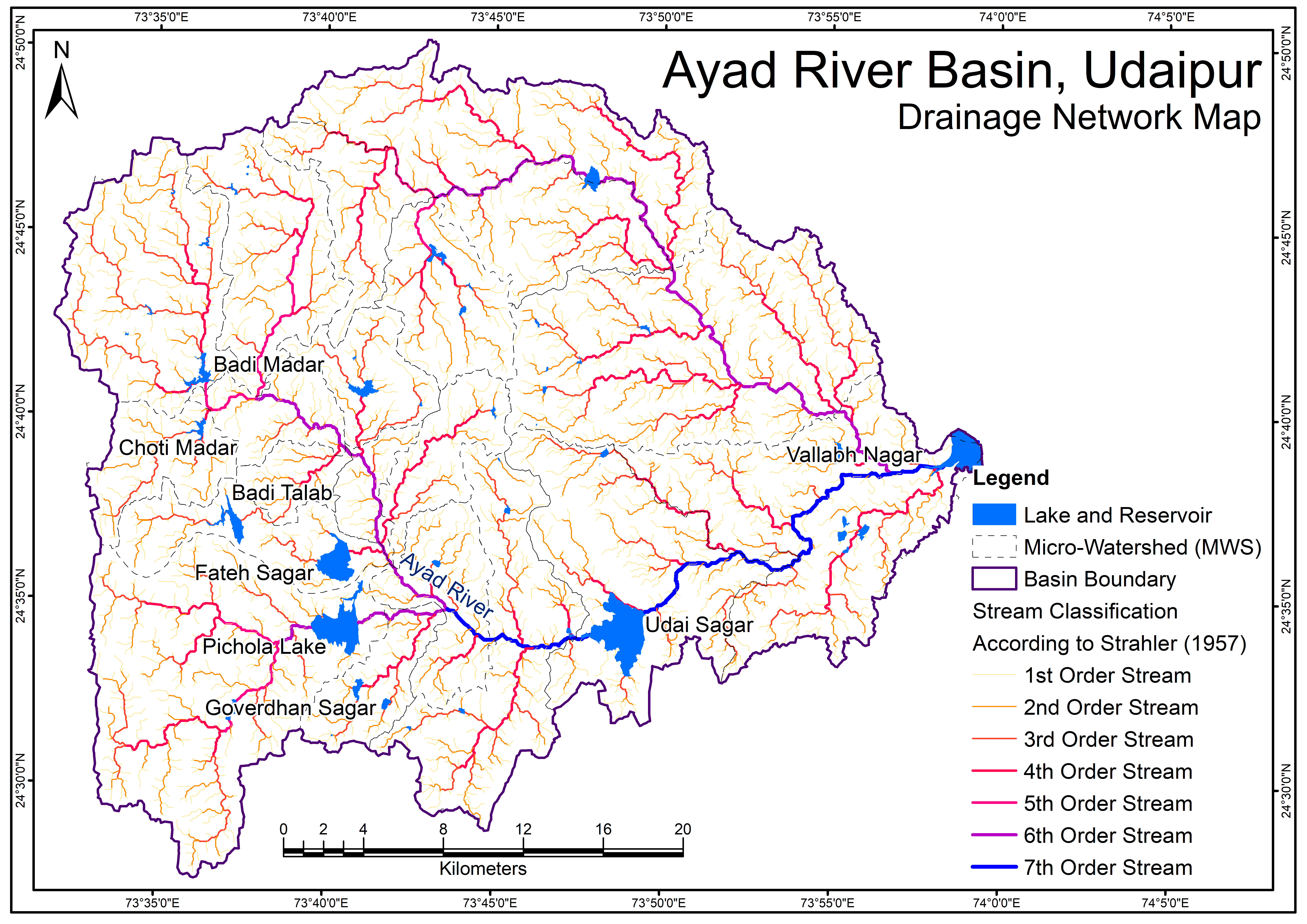
Perfumes
Drainage Network Map
Geological Map - Formation
View more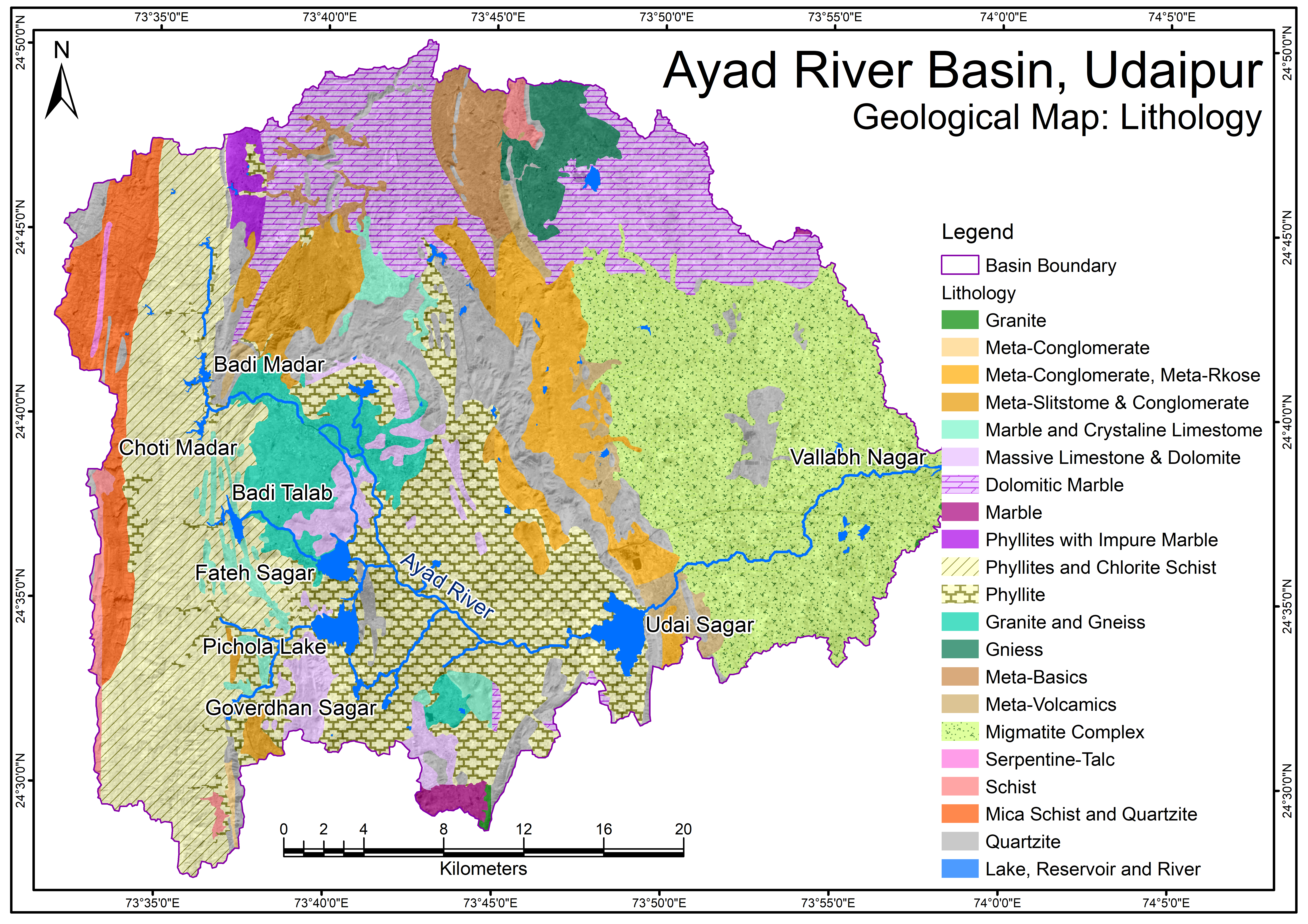
Geological Map - Lithology.png
View more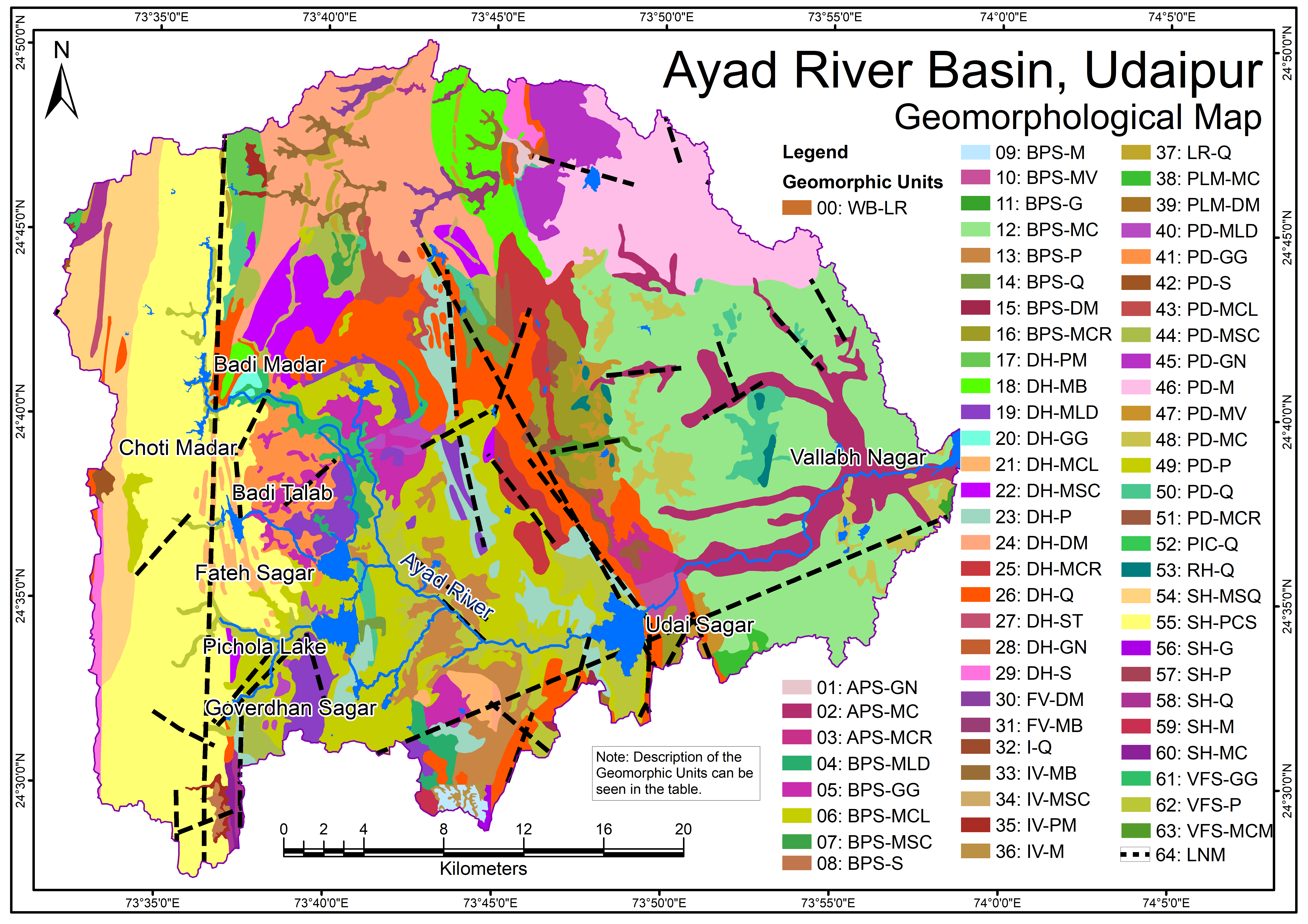
Geomorphological Map
View more.png)
Groundwater Flow Direction (Pre-Monsoon)
View more.png)
Groundwater Flow Direction (Post-Monsoon)
View more